- 首页 >> Research >> Research Progress
Research Progress
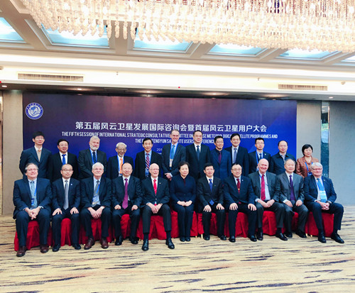
The Fifth International Consultative Conference on the Development of Fengyun Satellite and the First Conference of Fengyun Satellite Users were held successfully
From November 12 to 13, the 5th International Conference on Fengyun Satellite Development and also the first Fengyun Satellite User Conference was held in Chengdu. The conference was jointly sponsored by the China Meteorological Administration, the National Defense Science and Technology Bureau, the Chinese Academy of Science, and China Aerospace Science and Technology Corporation. The conference invited well-known experts at home and abroad to introduce the current situation and development of Fengyun meteorological satellites and the World Meteorological Organization space plan, and also conduct in-depth discussions on the development of Fengyun meteorological satellites, data products, service capabilities, and application demonstrations. The purpose of the discussions was to broaden the application areas, and deepen the application scenarios, which will further improve the application level of Fengyun meteorological satellites. As the most important research unit of the load parts of Fengyun series meteorological satellites, the Shanghai Institute of Technical Physics undertakes several development parts of Fengyun series satellites including FY-1 scanning radiometer, FY-2 scanning radiometer, FY-3 scanning radiometer, medium resolution spectral imager, infrared Spectrometer, Earth Radiation Retractor, Infrared Hyperspectral Atmosphere Detector, FY-4 Multi-channel Scanning Imaging Radiometer and Interferometric Atmospheric Vertical Detector, etc., and presented a special report on behalf of the Chinese Academy of Science on the conference.
The opening ceremony on the 12th was successively led by Liu Yaming, Director of China Meteorological Administration, Deputy Director Wu Yanhua of China National Space Administration, Yao Sidan, Vice Governor of Sichuan Provincial Government, Tillmann Mohr, Chairman of Fengyun Satellite Development International Consultation, Zhang Wenjian, Assistant Secretary General of World Meteorological Organization, Sun Weigang, Chief Engineer of Science and Technology Group and Yu Yingjie, Director of the Major Tasks Bureau of the Chinese Academy of Science delivered a speech.
The special guest report in the morning was mainly conducted by experts from Europe, the United States, the World Meteorological Organization and the China Meteorological Administration. The theme are "Space Climate Monitoring", "World Meteorological Organization Global Integrated Observing System", "Research on the Interaction between Opportunity and Convection Scale of New Generation Satellites", “The National Oceanic and Atmospheric Administration Satellite Project”, “the European Meteorological Satellite Organization Satellite Program: a component of the Global Space-Based Observing System”, and “the New Challenges for the Status, Planning, and Quantitative Applications of Fengyun Satellites”.
In the first half of the afternoon, the special academic exchange meeting was presided over by Director Yu Yingjie, Director of the Major Tasks Bureau of the Chinese Academy of Science. The deputy director of the 509 Institute of the Eighth Institute, Zhou Xubin, gave a report on the Status and Development of Fengyun Meteorological Satellite. Deputy Director Ding Lei of the Shanghai Institute of Technical Physics, on behalf of the Chinese Academy of Science, gave a special report on the "Imagination of Meteorological Satellite payloads". The report is based on the reality that the Academy of Science is deeply involved in most of the payloads of the Fengyun series of satellites, focusing on the timeline about these four aspects that what the Academy of Science have done, is doing and have planned to do in the field of meteorological satellites. At the same time, he also expressed the idea of the development of meteorological satellites in the two dimensions of high and low orbit classification and load function classification respectively, and discussed the ability of the Academy of Science to develop meteorological satellites covering radiation imaging, spectrum detection, radiation revenue and expenditure, Lidar class, atmospheric composition detection, space environment load and the small satellite constellation. He expressed the discipline strength and gave a future vision. Deputy Director of the National Meteorological Satellite Center Wei Caiying made a report on "Comprehensive Application and Service of Fengyun Satellite".
The second half of the afternoon was hosted by Deputy Director Ding Lei of the Shanghai Institute of Technical Physics. The reports were mainly presented by Yang Zhongdong (General Manager of Feng No. 3), Zhang Zhiqing(General Manager of Feng No. 4), Tang Shihao (Director of Remote Sensing Office), and Yan Danyu(Deputy Director of Meteorological Institute). The gave the reports from the perspectives of polar orbit, high-orbit detection capability, meteorological data product acquisition and application tools, and new application research. They also expressed the expectations of satellite and load capacity from the perspectives.
The conference reports received wide and enthusiastic attention from the participants. As the most important load development unit in the field of meteorological satellites, the designers of Fengyun No. 3 and Fengyun No. 4 of the Shanghai Institute of Technical Physics participated in the whole process of the user conference, and had a practical communication with the experts at the meeting. They made face-to-face statements and Q&A on their respective concerns. It changed the communication mode that the first-level user representatives directly communicated with instrument developer, and realized the direct communication between the instrument development party and the remote sensing data product producer and then the data terminal user. Through this new mode, the gap between the end user's understanding of the working principle of the instrument can be effectively reduced, and the mechanism of the problem of the specific remote sensing data product in practical application can be understood, and the instrument development can more accurately understand the application requirements of the end user.